Today we departed for our grand summer adventure from my folks home in
Stockton. The plan is to travel up Interstate 5 hitting some northern
sites as we go, visit family in Oregon and Washington, and then drive
down the 101 hitting all the northwestern sites as we go. When all is
said and done we hope to hit around 50 sites, see lots of family, and
enjoy some much needed family time!
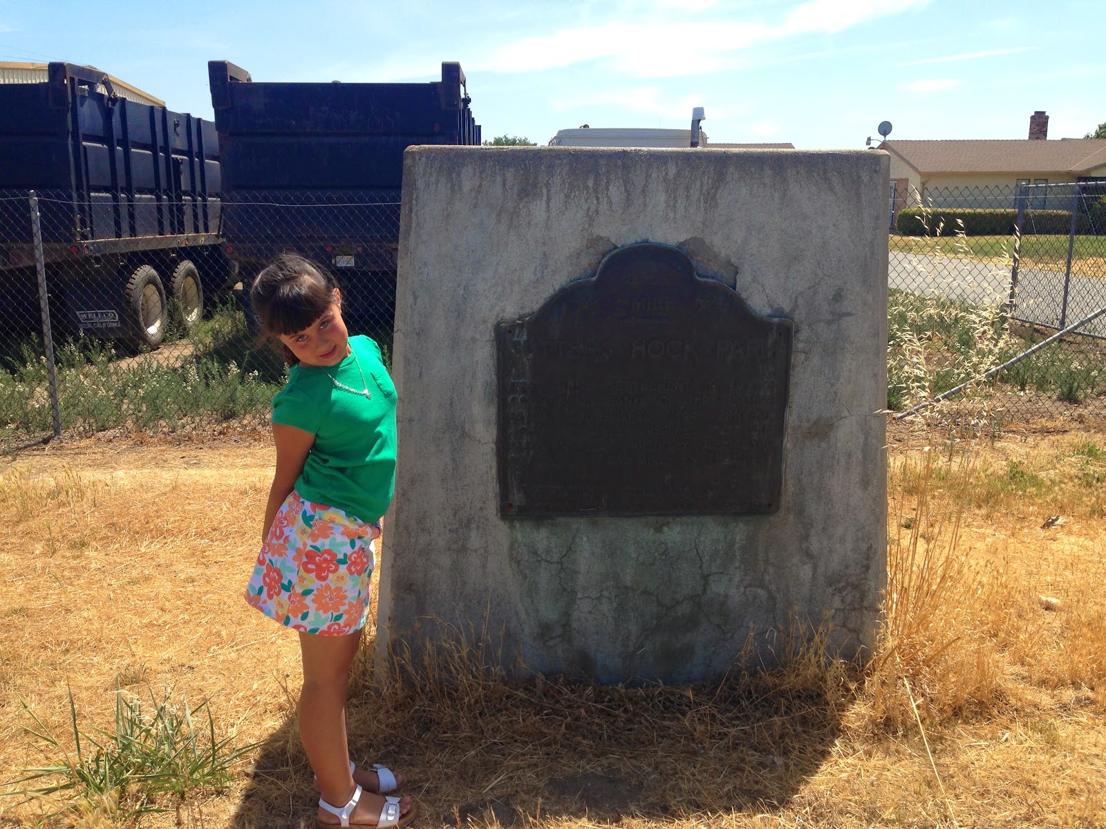
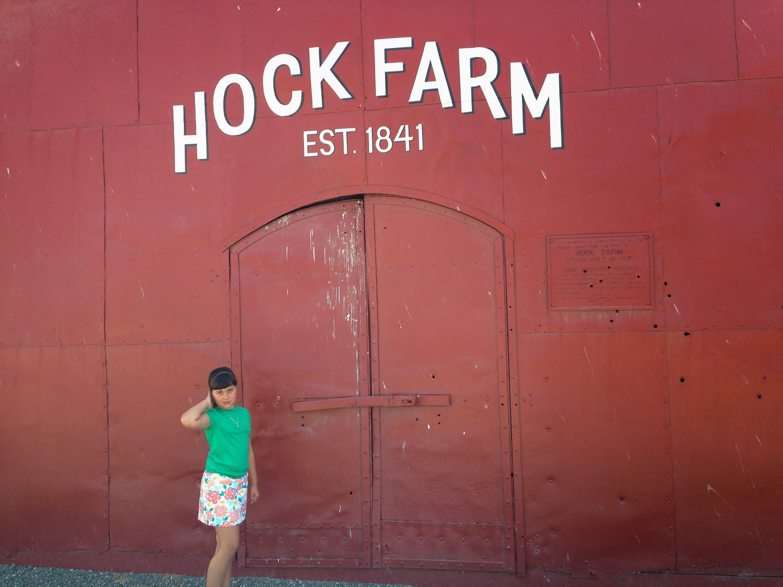
Our first stop was in Sutter County to visit one of two sites they have there, the
Site of Hock Farm (CHL 346). The farm established in 1841 by John Sutter was the first non-Native American settlement in the county. Sutter had hoped that he and his family could retire here, but he eventually lost the land due to high mortgages.
The farm was located on the Feather River and had cattle, orchards, grain and a vineyard.
The memorial building you see behind Libi is made from some of the iron that was used on the original buildings-- it's really cool up close!
Our next (and final) Sutter County site was for the
Propagation of the Thompson Seedless Grape (CHL 929). It was here that the English immigrant William Thompson settled and grew the first Lady de Coverly grapes.
Out of the three cuttings he purchased from New York only one survived due to flooding. His seedless grade was displayed in Marysville in 1875 and named the Thompson seedless grape. From this one surviving plant all the seedless grapes in California were propagated.
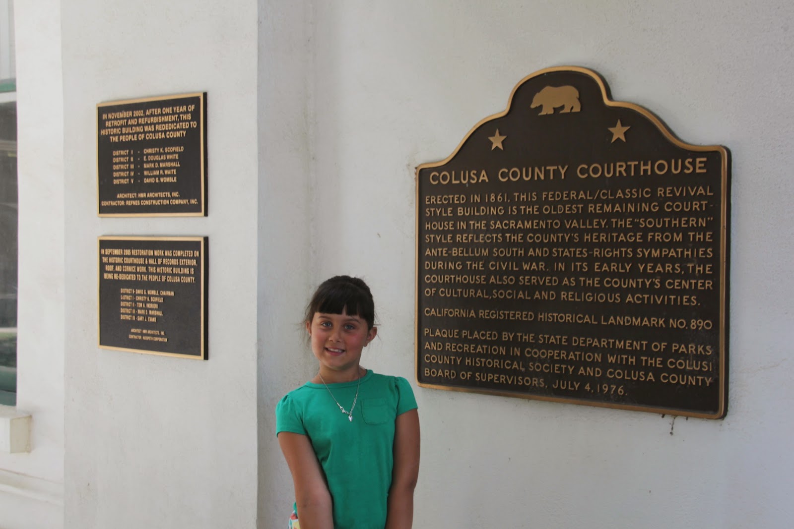
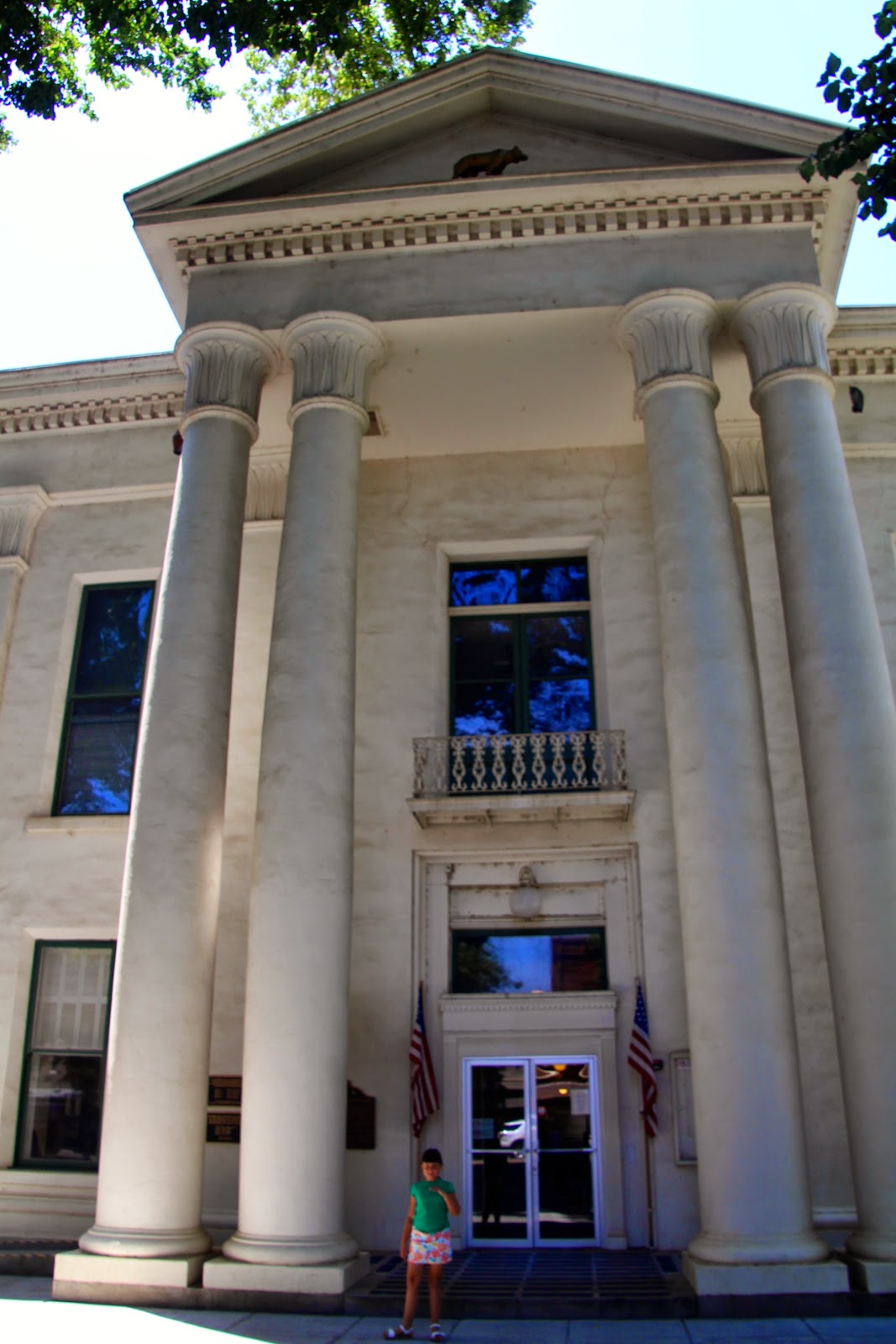
We kept moving north to Colusa County. Our first stop was the
Colusa County Courthouse (CHL 890).
This is the oldest courthouse in the Sacramento Valley.
Built in 1861 using the Federal/Classic Revival style architecture-- the state says that this southern style architecture was
evidence of the county's states' rights sympathies during the Civil
War.
We didn't find anything to point to that while we were there but
we will take their word for it.
Since we visited on a weekday we were able to walk through the halls. We found some really cool things including this Washington sculpture...
and this poster inside their hall of records.
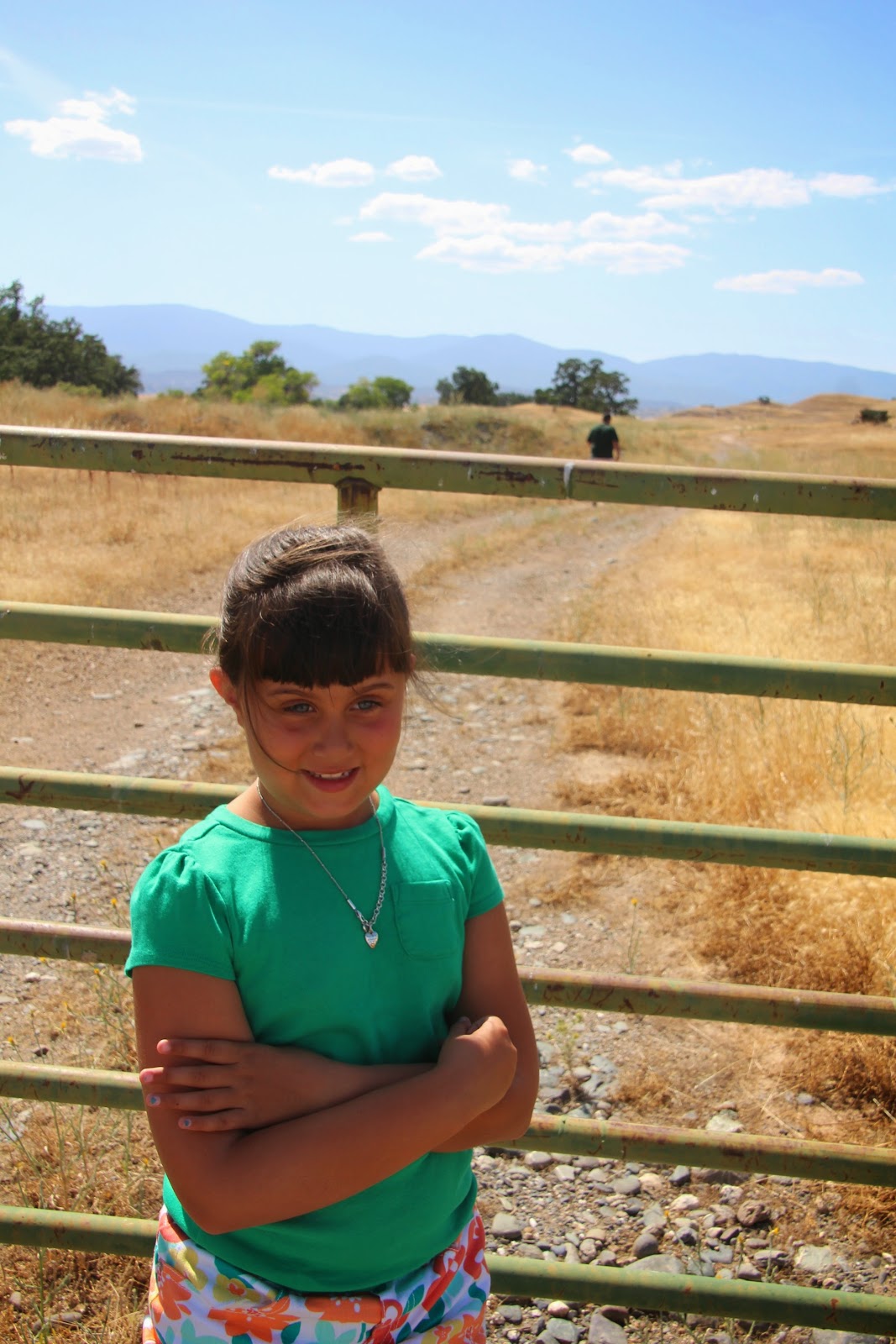
Our next Colusa sight was way off the beaten path--
Swift's Stone Corral (CHL 238).
You can see the stone corral outline on the hill in the photo above. Granville Swift (who you will learn more about at our next site) built this corral out of stone when he realized that there was no timber in the surrounding county. There were lots of flat stones in the area, so they used them and along with his partner Frank Sears they built this corral.
In Glenn County our visit with Mr. Swift continued at the
Granville P. Swift Adobe (CHL 345).
Granville came to California via Oregon from Kentucky. Granville was quite the guy-- his great uncle was Daniel Boone, he participated in the Bear Flag Revolt, he helped design the bear flag, and in 1848 he struck it rich mining gold. In 1849 he partnered with Frank Sears and purchased a cattle ranch. His cattle was herded by Indian vaqueros. Rodeos were held here at the adobe annually.
Our next find was quite exciting-- since it was nowhere near where the state said it would be and many of the sites we use as reference hadn't located this plaque. We were victorious and did locate the
Site of the First Posted Water Notice by Will S. Green (CHL 831).
William Semple Green is called the "Father of Irrigation in California"-- due to all the droughts that plagued the Sacramento Valley he was a believer that irrigation would bring more people to settle here. He posted a notice on an oak tree on December 18, 1883 stating that 500,000 miner's inches of river water was being diverted for irrigation. Will Green held many important titles including CA state assemblyman, CA state treasurer, and US Surveyor General for California.
Our next site is a first for us-- Ron's rule for getting sites is that we get as close as we can without trespassing. Today Ron broke that rule!
I knew that there was a private plaque for the
Indian Military Post, Nomi Lackee Indian Reservation (CHL 357) due to some research beforehand.
When we finally found the site down a long dirt road we could see the plaque in the distance...
but the gate on the road stopped Libi and I.
Ron was not deterred-- and he climbed the fence and went in.
Libi and I watched from the safety of the car while Ron got the plaque photos!
Now about the site--- It was here that the Nomlaki Indians (not sure why the state misspelled their name) were rounded up before being moved to Round Valley in 1866. During the difficult move about half of them perished during the walk. Today only two people still speak the Nomlaki language, but they are trying to increase that number.
Next we drove to a neighborhood in Tehama to find the next site,
First Tehama County Courthouse (CHL 183).
On nearby land was the Union Hotel, where the County Board of Supervisors rented space to meet from 1856-1857 when the county seat was moved to Red Bluff.
A short drive away we found the
Home of Mrs. John Brown (CHL 117).
You may recall John Brown the abolitionist who made history at Harper's Ferry-- if not you can read his story here.
In this home (which is now a doctor's office) John Brown's widow and children lived until 1870. The house was actually purchased by people in the area who respected John Brown and his ideals. (note from Ron: as we drove to this site, Heather told me that I would be jazzed about this site. I am quite the John Brown enthusiast, so I was SUPER excited to visit here!!)
Next we came upon the
Residence of General William B. Ide (CHL 12).
William B. Ide was a participant in the Bear Flag Revolt who also wrote a mandate encouraging American annexation of California.
Under the Bear Flag Party he was appointed the first and only President of the California Republic. Sadly the adobe was already closed by the time we arrived.
We now leave Tehama County and moved to Shasta County to see the
Reading Adobe (CHL 10). This site is in a residential neighborhood down another dirt road.
Pierson B. Reading was another pioneer who participated in the Bear Flag Revolt. He was one of the first to visit the location of the Marshall gold discovery, he prospected for gold himself, was a Whig candidate for governor, and a very influential early Californian.
Next up was
Fort Reading (CHL 379) named after Pierson B. Reading.
The fort was built in 1852 to protect the settlers from the local Native Americans. It was the first and largest fort in Northern California. The fort flooded often when Cow Creek overflowed during the rainy season so the fort was eventually abandoned in 1867.
Our final site for the night (or at least we thought it was going to be our last) was the
Dersch Homestead (CHL 120).
This home was built in 1850 by Doc Baker as a stopping point for emigrants following the Lassen or Nobles Trails into California. In 1861 the Dersch family took over the land. In 1866 after years of bad relations between the whites and the natives a raid of the homestead occurred and Mrs. Anna Maria Dersch was killed. A posse was formed to go into the Dye Creek Indian Camp and most of the natives who lived there were killed as retaliation.
We had a lovely dinner with Ron's former principal and his family. Afterward John said that he knew where a few historic sites were near their home, so off we went! Our first stop was the
Old Town of Shasta (CHL 77).
The town was originally named Reading's Springs (after our friend above Pierson Reading) but was renamed Shasta in 1850. It was quite a booming place since the road ended here and the Oregon pack trail began.
Even though the main business section was destroyed by fire in 1853, many of the original shells of the buildings were preserved and are there today.
We did a little exploring before driving to our next site.
This one was pretty cool-- the
Pioneer Baby's Grave (CHL 377). The plaque is above but the grave still exists down a set of wooden steps.
Charles Brownstein died as an infant in nearby Red Bluff in 1864. His parents wanted to bury him in a Jewish cemetery, but there wasn't one near their home.
They made the difficult journey to Shasta to bury him. Concern for his grave caused a rerouting of Highway 299 in 1923. People still visit and leave toys for the pioneer baby.
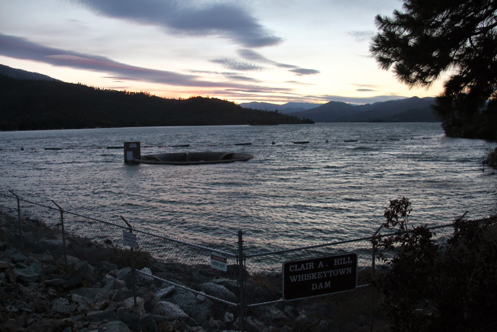
Next we visited the Whiskeytown Dam which was as close to
Whiskeytown (CHL 131) as we got..
The dam was dedicated by JFK-- one of Ron's favorites.
The town was settled in 1849 as a mining town along the Whiskey Creek.
The creek got its name when a barrel of whiskey fell off a pack mule and broke in the river.
Thanks John, Ginny, and Jeffrey for a fun night!