For President's Day weekend we decided to head up north to visit Jammy and Granpa, which gave us a perfect opportunity to visit some NorCal CHLs. Today took us to gold country-- mostly to Calaveras County.
Our first stop of the day was the city of Copperopolis (CHL 296). As you have probably guessed from the name, this site was a rich copper deposit (as opposed to the more well-known gold sites).
This was the second copper deposit found in the area-- the first being Telegraph City. Copper was in high demand during the Civil War and Copperopolis boomed! The copper was mined here, shipped to Stockton, moved to San Francisco, loaded onto ships, and sailed through Cape Horn to get to the smelters on the East Coast. As you can imagine this was an expensive process, so after the war things slowed down for the mine. They did have two more booms during the World Wars, but the mine finally closed in 1946. It produced over 72 million pounds of copper worth over twelve million dollars!
They appear to be trying to revitalize this area-- opening a new downtown area with period-looking buildings. It will be fun to come back and explore a little more.
We drove south of Copperopolis to O'Byrne Ferry (CHL 281). In 1852 Patrick Byrne created a chain cable bridge across the Stanislaus River and collected tolls as folks passed from Calaveras to Tuolumne Counties. Sadly the bridge was destroyed multiple times due to structural failure and flood, but each time it was re-built.
The bridge was finally cut down, splashed into the river, drug to the shore and taken apart after the Tri-Dam Project voted to flood the dam. It is said that pieces of the bridge were turned into benches in Copperopolis, so we will have to look for those next time!
Our route changed a little, when Ron's CADA friend, Verne, invited us to brunch in Murphys. Our goals included the town today, but after a few other stops-- flexibility is key when you are adventuring!
Happily they wanted to have brunch at the Murphys Hotel (CHL 267-- which is listed as the Mitchler Hotel).
We were very excited that they had their display room open to view-- the Ulysses S. Grant room. Our president actually slept here in this bed and had his hair cut in the barber chair on the far side of the room.
This piano-- also in a rectangular shape like we saw in the
Stagecoach Inn-- is said to be the second oldest in California. Do you remember why they are rectangular in shape? They had to fit on the covered wagons!
On each door of the main hotel building has the name of a famous guest who stayed there-- William Randolph Hurst, Daniel Webster, Mark Twain-- and you can stay there too! They actually rent out the rooms to the public-- even the Ulysses S. Grant room!
The hotel has gone through multiple owners and name changes...
which explains the multitude of plaques outside explaining its history!
The restaurant is fun-- a good place to stop when you visit!
Next we walked across the street and down half a block to our next site-- the Peter L. Traver Building (CHL 466).
Constructed in 1856, this is the oldest stone building in Murphys.
It has withstood fires for years and served as a store, a Wells Fargo office and a garage.
Now it serves at the Old Timers Museum, which has fun local history, a gift shop, as well as artifacts from the ECV.
For those of you who do not know what the ECV is, it stands for
E Clampus Vitus. It is a fraternal organization that specializes in the history of the west. The groups history is unclear-- as they don't have a website or really want outsiders to know much about them-- but they were extremely popular in the 1850's. They have legendary initiation rituals and a reputation for being rowdy! For their meetings they built Halls of Comparative Ovations, generally the back room of a saloon-- one still stands in Murphys!
While the Clampers are known for being rowdy-- they do take care of their own (often doing fundraisers for members or mining descendants who need help) and they care very deeply for preserving California history. Many of the plaques and sites we have seen thus far on our adventures had ties to the ECV-- either the plaque was purchased by them or the site was restored by them.
Ron is waiting for his invitation to a kinder, gentler chapter of the ECV-- if anyone reading this has an in.
While we weren't invited into their Hall, we did get to see their wall! On the side of the Traver Building we found these interesting plaques.
These tiles featured people or events of historic significance to the region...
Thanks to Verne and Melissa Johnson for taking time to share in the adventure with us!
We couldn't resist the chance to pose with a gold-panning frog!
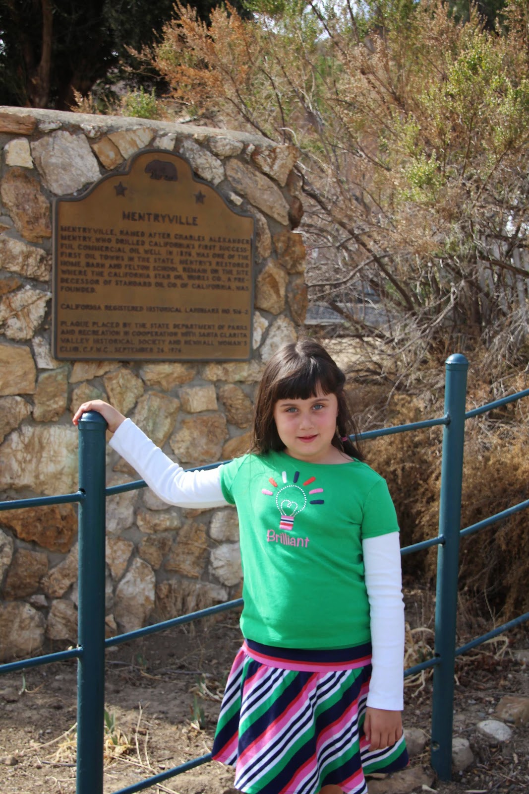
Enough sight seeing-- on with the historic sites! Murphys was founded by two brothers who were part of a gold searching expedition. They camped here, and never left!
In the center of town is the plaque for the town of Murphys (CHL 275).
Miners found over $20 million dollars in gold here!
We just love all the streams we have passed...
so we stopped here in Murphys to take a photo next to one.
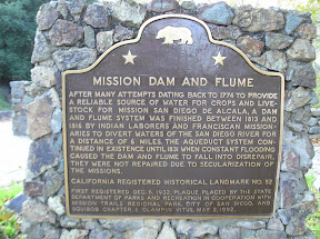
One of Murphys' other claims to fame is their wooden water flume-- built in the 1850's by miners with hand tools it still supplies all the water to Murphys and Angels Camp.
This was absolutely remarkable to see, winding below the roads.
Verne was explaining to us that back in 2001 that a fire destroyed part of the flume. The two towns were on water restrictions with limited water for months while they tried to repair it. What men built with hand-tools, wood, and gumption took 9 months to repair with modern technology.
Next we drove to Brownsville (CHL 465)-- a mining town between Murphys and Angels Camp.
This camp on the Pennsylvania Gulch allowed miners to have two claims-- one wet and one dry-- which was uncommon in the area. Most places you could only lay claim to one area.
The marker is located next to a vineyard-- I didn't realize there were so many wineries in Calaveras County. According to our local friends, that is the major money-maker of the area now since the mining is done.
I love this cool tree and gravel we saw on this stop.
Next we were on to Douglas Flat (CHL 272). We were supposed to be able to find a plaque here...
but after driving through town twice, we discovered that there is none.
In lieu of a plaque we decided to take a photo next to the schoolhouse.
Douglas Flat was a mining camp where $130,000 in gold was found.
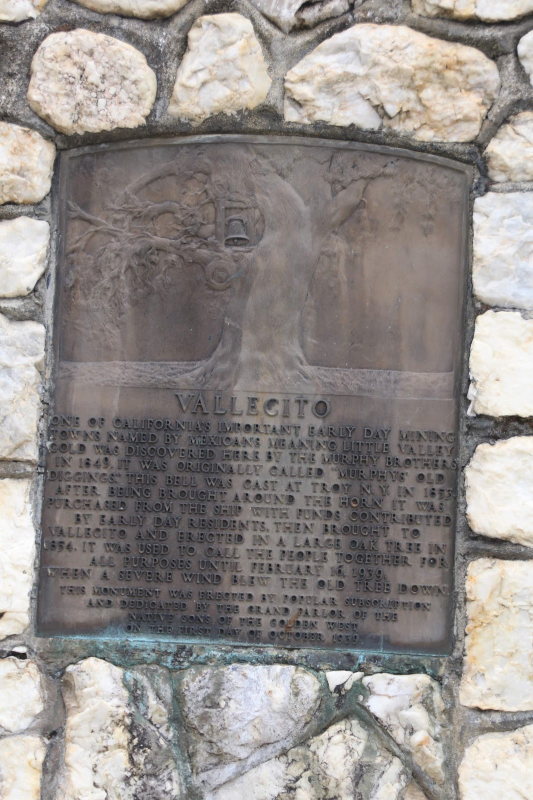
Vallecito was next (CHL 273), but sadly there was no plaque for the town...
however, there was a plaque and site for Vallecito Bell Monument (CHL 370).
"Little Valley" was a mining camp that was destroyed by fire. Close to the town is Moaning Cavern, a Native American burial ground where you can now go spelunking.
The bell monument is here to honor a bell that was cast in New York and paid for by citizens of Vallecito. It was hung in a huge oak tree and used to call people together for news until the tree blew down.
Angels Camp (CHL 287) was next on the journey (notice the frog sitting on top of the monument).
The frogs are everywhere in Angels Camp due to their proud ties to the Mark Twain story the Jumping Frog of Calaveras County. The town of Angles Camp boomed due to gold and quartz mining.
On the main street of Angels Camp sits the Angels Hotel (CHL 734)-- the site where Samuel Clemens aka Mark Twain first heard the tale that would become a short-story that made him famous!
We will have to come back and walk the streets here another day to see what else Angels Camp has to see.
We drove a short distance to Altaville-- aka northern Angels Camp.
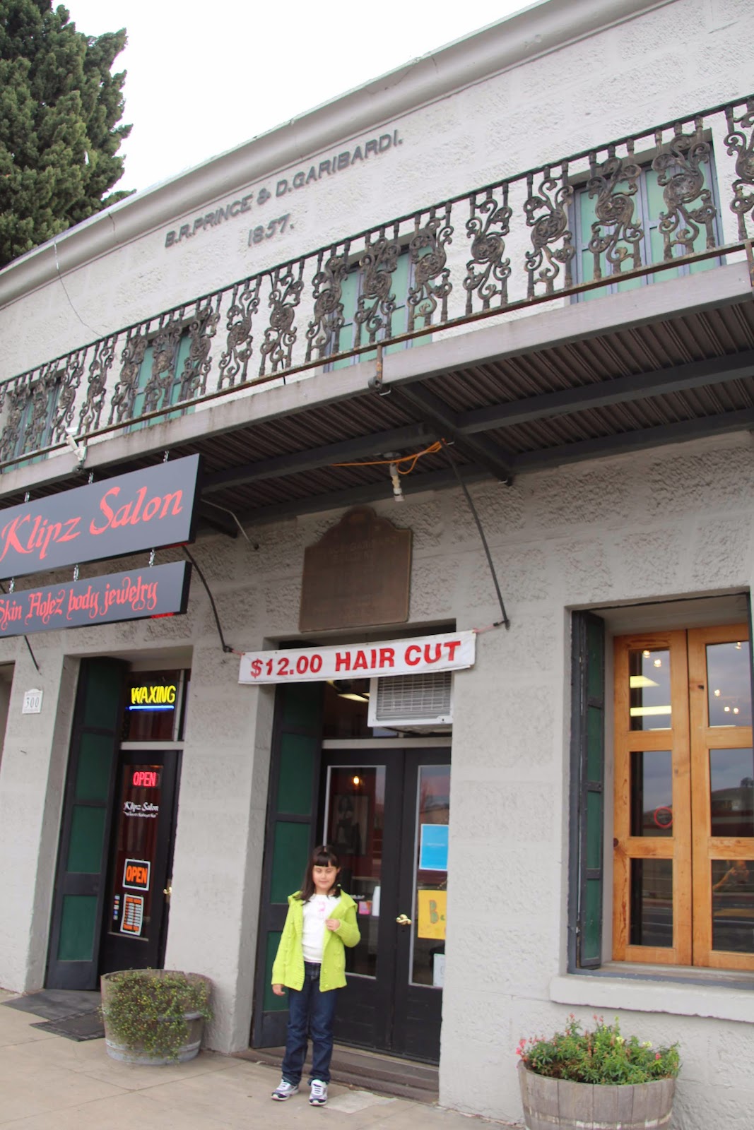
Our first stop was the Prince-Garibardi Building (CHL 735)-- a general store building that still remains to this day...
now it serves as a hair salon. Libi felt funny standing in front of this business, but it's all in the name of her adventure!
The town of Altaville (CHL 288) was the site of the foundry for Calaveras Country since 1854.
This site was cool-- it looked like ruins but it was inside a grocery store/Burger King shopping center.
Sometimes getting these photos is tricky-- Libi has to climb through brush, plants, mud, etc. to get as close as possible to the plaques.
Our final stop in Altaville was the Red Brick Grammar School (CHL 499). This is one of the oldest schools in California-- they raised the money for it by having a dance in the saloon.
The school was in use up to 1950, when it was replaced by the Mark Twain Elementary School.
The school was closed today, but I was able to get some good photos of the interior just holding my camera up to the window.
We have seen so many cute little school houses thus far-- it makes me proud to be a California educator carrying on the legacy of these early teachers!

After a brief detour when we mixed up our directions, we headed down Highway 49 to
Carson Hill (CHL 274).
There are actually two sites here--
The first is the actual Carson Hill named after James Carson. He was in the same expedition as Murphy, but he stayed here when the rest went on. Gold was so abundant here that most folks didn't even have to dig for it-- they just blew up a vein and picked the gold up off the ground.
It was near here that the one of the largest gold nuggets in California was found-- it was worth $43,000 at the time! There is also a story in the local history of a miner who passed away. During his burial they looked down, saw something glittering and the entire mourning party forgot the funeral and laid claim to the area (even the priest was said join in.)
The second site has to do with the ECV-- it's the
birthplace of Archie Stevenot (CHL 769).
Archie comes from a family who founded the borax industry in California. He was quite an entrepreneur who had many jobs. He was passionate about this region of California and earned the nickname Mr. Mother Lode. He was the Supreme Noble Grand Humbug of ECV as well as the founder and president of the Mother Lode Highway Association.
He was so passionate about the region that they named this bridge in the background of the photo the "Archie Stevenot Bridge"! Libi is posing next to a time capsule and plaque about Archie.
The bridge plaque is next to Robinson's Ferry (CHL 276). This was the site of a ferry that took miners, freight and animals across the river.
It was a perfect spot for a family photo!
We still had some sunlight, so we decided to hit a few Tuolumne County sites we passed as we sped to brunch this morning.
Our first Tuolumne stop for the day was Mark Twain's cabin (CHL 138). This is a replica of the cabin Samuel Clemens stayed in when he got the inspiration for his famous story mentioned above.
The tiny cabin still has the original fireplace and chimney.
Ron was struck by how small this one-room cabin was-- it is hard to believe that a man as famous as Mark Twain had such shabby accommodations.
Next was
Tuttletown (CHL 124), a stopping place for "men and mounts" named for Judge Anson A. H. Tuttle.
Keeping with the Mark Twain lore-- it is said that he traded at the general store here. It should also be noted that the plinth is said to be made of stones that used to be part of the general store building.
On our drive through Tuolumne we noticed the Sheriff's Posse-- this isn't a CHL, but it was such a novel site to us that we had to take a quick photo. Ron and I both agreed that it would be cool to be part of this posse!
Our final stop for the day was Jamestown (CHL 431).
This was another site where gold was found-- mostly in the stream. It is now best known (as their sign says) as a gateway to the Mother Lode and southern mines.
It was a great day in gold country--we can't wait to come back and explore more along the Mark Twain/Bret Harte Trail.