Sunday, November 17, 2013

Driving Through the San Joaquin Valley on Veteran's Day - 11/11/2013

We were headed home from Heather's parents' house in Stockton after a three-day weekend, and we always have the choice of heading down Interstate 5 or Highway 99. On Veteran's Day 2013, we chose the 5.

Our first stop was a two-fer, and it's located right where Interstate 205 branches off from I-5 in Lathrop. This is the location of two landmarks: First Transcontinental Railroad - Site of Completion of Pacific Railroad (CHL # 780-7) and First Landing Place of Sailing Launch Comet (CHL #437).
If you remember your history of the west, you've heard the story of Promontory Point, Utah, and the driving of the Golden Spike. Below is the photo taken on May 10, 1869, the day of the famous event. However, that final spike joined two rail lines that could only take you as far west as Sacramento. There is a fascinating story about the two engines you see in the photo below (the Jupiter and No. 119) told by the National Park Service. I don't have time to re-tell it in my blog, but you can check it out HERE.
Photo courtesy of the National Archives and Records Administration.

The completion of the Mossdale Bridge over the San Joaquin River in September 1869 was what actually connected the Transcontinental Railroad to the San Francisco Bay. 
The sailing launch, Comet, arrived here in 1846 from San Francisco Bay, carrying a group of Mormon settlers, led by our hard-drinking, gambling friend, Sam Brannan! If you have been following our adventures carefully, you may remember the story of Sam Brannan from our Sacramento trip.

One of the things we have noticed on our travels is that so many of these plaques have been stolen. Two plaques were stolen from this plinth. The Comet plaque is supposed to go on top, and the Railroad plaque was originally placed below. It's sad. Who does this? I did a Google search for "california historical landmark black market." I couldn't find anything.
Our next stop: another stolen plaque. It marks the site of San Joaquin City (CHL #777). San Joaquin City was one of the many "stop-along-the-way" towns that sprang up during the Gold Rush. 
 The plinth was missing its plaque, but I did get some fun shots of this old out-building.
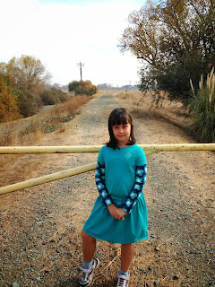
Ag country here in the heartland of California has seldom-traveled roads, so I was able to set my iPhone in the middle of the street for this shot.
Speaking of roads less-traveled, we weren't even able to get out to our next landmark, because the levee had a gate across it. According the woman on the golf cart who shooed us away for parking on the levee, there was a marker out here a while ago, but flood waters swept it away many years ago. It was the Site of Battle Between Forces Under General Vallejo and San Joaquin Valley Indians (CHL #214). From the state of California: "In 1829, the Governor-General of California directed Vallejo to punish the Cosumnes Indians for their raids on local ranches. The battle is one of the few fought in California in which cannons were actually used." I'm guessing it was General Vallejo and his forces who had the advantage of cannons. Mariano Vallejo is a prominent figure in California history. He had dealings with Pio Pico, John Sutter, and John Bidwell. The city of Vallejo was named after him, and the city of Benicia was named for his wife, Francisca Benicia Carrillo.
So, we wound back around the Cosumnes River, got back on the 5, and continued south. We had to take a slight detour onto Highway 152 to get to our next stop, the Pacheco Pass (CHL #829).
Bella was a bit slighted at the "no pets" sign, so instead Heather and I took turns heading out to this plaque overlooking the San Luis Reservoir.
The Pacheco Pass was (and still is) a major route from the Santa Clara Valley and adjacent Bay Area in the west to the San Joaquin Valley in the center of the state.
 We then hopped back on Highway 152 and headed east, to Los Banos. I'm conflicted over whether to call it Los Banos or Los BaƱos, the original Spanish spelling. The city's website omits the tilde over the n, so Los Banos it is. We first stopped at the Canal Farm Inn (CHL #548). "This original San Joaquin Valley ranch headquarters of California pioneer and cattle baron Henry Miller (1827-1916) was established in 1873. His farsighted planning and development in the 1870s of a vast gravity irrigation system, and the founding of Los Banos in 1889, provided the basis for this area's present stability and wealth."

Our last stop of the day marks the city of Los Banos (CHL #550). The creek here would serve as a water source for the booming agricultural industry that would come to the San Joaquin Valley.

That was our trip home! Next weekend, we're off to visit the northwest corner of Los Angeles County.

0 comments:

Post a Comment

Format for hashmark fragment identifier

Click the edit icon to reveal code